The Qing Dynasty Map
This map shows the land area of the Qing Dynasty (1644 – 1911), the capital city of Beijing, and the modern-day borders of China and Mongolia.
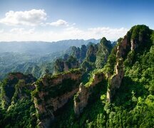
Qing Dynasty Map. Click to enlarge!
Top Cities in China
- Beijing Travel
- Shanghai Travel
- Guangzhou Travel
- Hong Kong Travel
- Guangzhou Travel
- Hangzhou Travel
- Guilin Travel
- Suzhou Travel
- More China Cities
China City Maps
- Beijing Maps
- Shanghai Maps
- Guangzhou Maps
- Hong Kong Maps
- Guangzhou Maps
- Hangzhou Maps
- Guilin Maps
- Suzhou Maps

China Highlights- Ancient China Maps
- Taiwan Map In 1896
- Changan In Sui And Tang Dynasties Map
- Ancient Silk Road Map
- Han Dynasty 2 Map
- The Neolithic Age Map
- The Shang Dynasty Map
- The Western Zhou Dynasty Map
- The Eastern Zhou Dynasty Map
- The Warring States Period Map
- The Qin Dynasty Map
- The Han Dynasty Maps
- The Sui Dynasty Map
- Tang Dynasty Map
- Five Dynasties Map
- Northern Song Dynasty Map
- Southern Song Dynasty Map
- Yuan Dynasty Map
- Mongol Empire Map
- Ming Dynasty Map
- Qing Dynasty Map
- People's Republic of China Maps
Best of China


