The Warring States Period Map
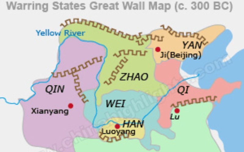
The Warring States Period Map shows the land divisions by many regions during the Warring States Period. Click it to enlarge.
From 475 BC to 221 When the Qinshihuang unified the country, is known as the Warrior Period. It is obvious so named for wars between the states continued, even intensified. This period is traditionally regarded as the beginning of the feudalism in china.
Read more information about the Warring States Period and check out more about Chinese history.
Top Cities in China
- Beijing Travel
- Shanghai Travel
- Guangzhou Travel
- Hong Kong Travel
- Guangzhou Travel
- Hangzhou Travel
- Guilin Travel
- Suzhou Travel
- More China Cities
China City Maps
- Beijing Maps
- Shanghai Maps
- Guangzhou Maps
- Hong Kong Maps
- Guangzhou Maps
- Hangzhou Maps
- Guilin Maps
- Suzhou Maps

China Highlights- Ancient China Maps
- Taiwan Map In 1896
- Changan In Sui And Tang Dynasties Map
- Ancient Silk Road Map
- Han Dynasty 2 Map
- The Neolithic Age Map
- The Shang Dynasty Map
- The Western Zhou Dynasty Map
- The Eastern Zhou Dynasty Map
- The Warring States Period Map
- The Qin Dynasty Map
- The Han Dynasty Maps
- The Sui Dynasty Map
- Tang Dynasty Map
- Five Dynasties Map
- Northern Song Dynasty Map
- Southern Song Dynasty Map
- Yuan Dynasty Map
- Mongol Empire Map
- Ming Dynasty Map
- Qing Dynasty Map
- People's Republic of China Maps
Best of China


